We have been weekending in Newnes for years. Leaving work on Friday already packed. Shooting up and over the Blue Mountains, the Oztent is up and dinner is cooking in no time. Accessible, beautiful and cathartic. The ABC of easy camping.
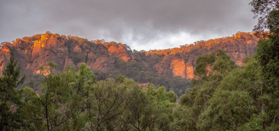
The flora and fauna of the cliffs and canyons, have taken the Shale mine settlement back. Now, weekend campfires trail their signals sky high, instead of steam engines and coke ovens.
Located north of Lithgow, NSW it’s no wonder weekends can be popular at Newnes. From Sydney, it’s only a few hours’ drive. Grabbing groceries at Blackheath or elsewhere on the way for the campfire kitchen. There is a short drive on the Castlereigh Highway before swinging North at the stacks, towards and through Lidsdale. Well signed, and sealed, the road is narrow. Gradually the road begins to wind with more fervour,the cliffs grow and become distracting. Shouldered by farmland most of the way. There is a particular narrow section, where stopping is prohibited, go slow and give way to anyone coming up.
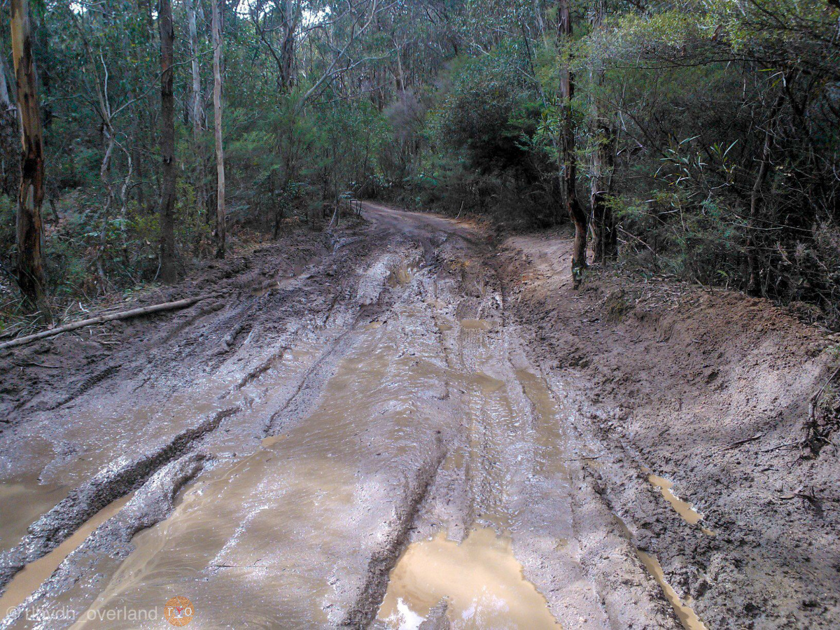
The road hugs the crumbling side of the range before descending into the wilds beyond. The bitumen ends at the opulent Wolgan Resort, but our humble luxury begins now. The condition of the road varies. In the years we have frequented, the road has been graded but easily descends into a corrugated, potholed but otherwise beautiful two way trail. It twists with the wooded Wolgan River, so keep it left and slow. We generally air down for this, after a few hours of highway haul, our tyres are hot and high. There is no reason to shake your refrigerated treats to oblivion before getting to camp.
The trees part for lawn as you find yourself within eyeshot of the Newnes Hotel, relocated and re-purposed to a museum and gatekeeper to the history and preservation of the area. Firewood, drinks, mud maps and showers can be purchased. Paid camping is available here.
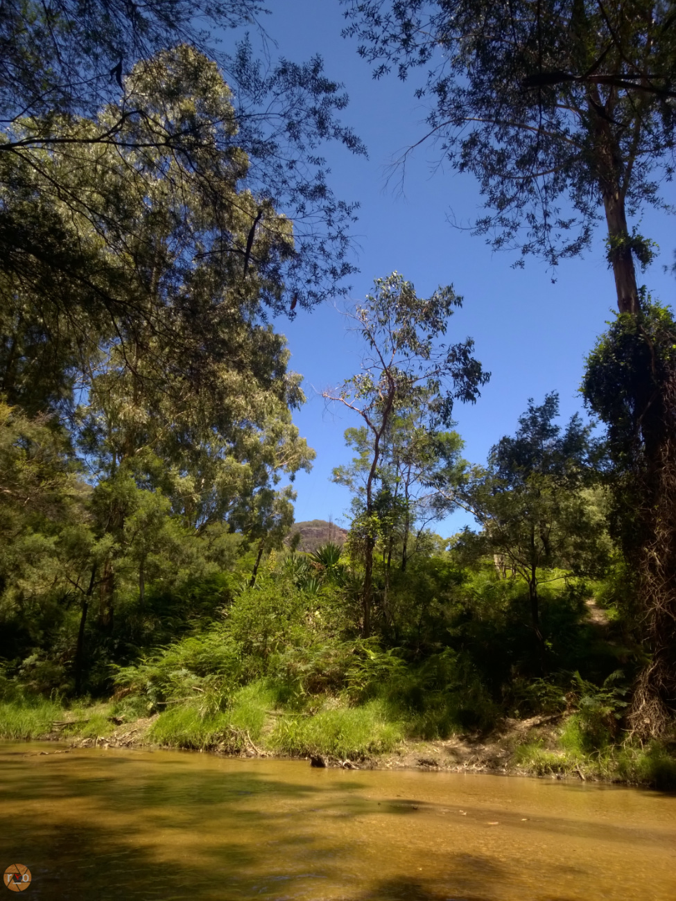
Keep going, past more relics and a solar farm, and you’re offered a ford across the Wolgan River. Drought has depleted the water level, and increased traffic has led to it being graded. The soft sand is gone. As of early 2019, the crossing is barely hub deep and is a firm rocky crossing. Weather and water levels can change this, so make your own decision on your visit.


This accesses the mining walks and glow worm tunnel walk. Also, our chosen camping area. A smaller area, but usually less populated, depending on the crossing. There is one toilet, and access to the river on one side. Along the riverside (left) of the trail there is space, where we have made camp when the main two areas are populated.

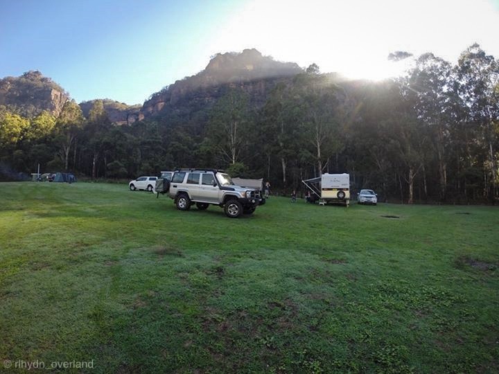
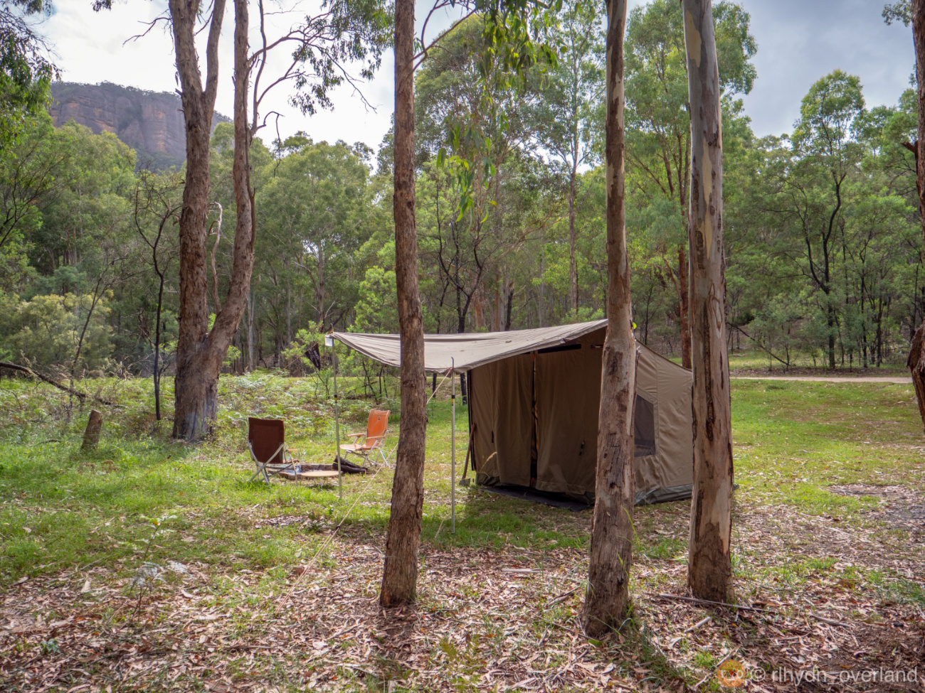
Forgoing the ford, you can meander straight ahead. After a concrete causeway for a riverlet (water levels vary between dust and decent) the main camping area opens in front of you. Expansive, and sheltered by a crescent moon of glorious cliffs.

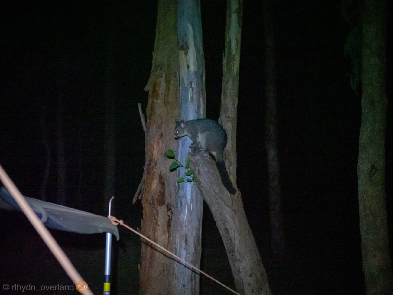
An abundance of kangaroos, goannas, possums and shy wombats reside in the valley. We’ve also seen an impressive flock of squeaky gate Gang Gang cockatoos. There are two toilets.
I still remember our first visit, the dead of winter. The sun didn’t find the valley until almost 10am. And it left us again around 3pm. In the height of summer, the treeless grassy area becomes dry and hot. Welcome relief can be found in the cold Wolgan River, even if only ankle deep.
Aside from simply camping, there are multiple activities to fill your weekend. A three hour return walk around the ruins of the shale mining enterprise is a terrific journey through time. Cheap imports and lacklustre government support killed off the remote but rich shale reserve for good by 1932.

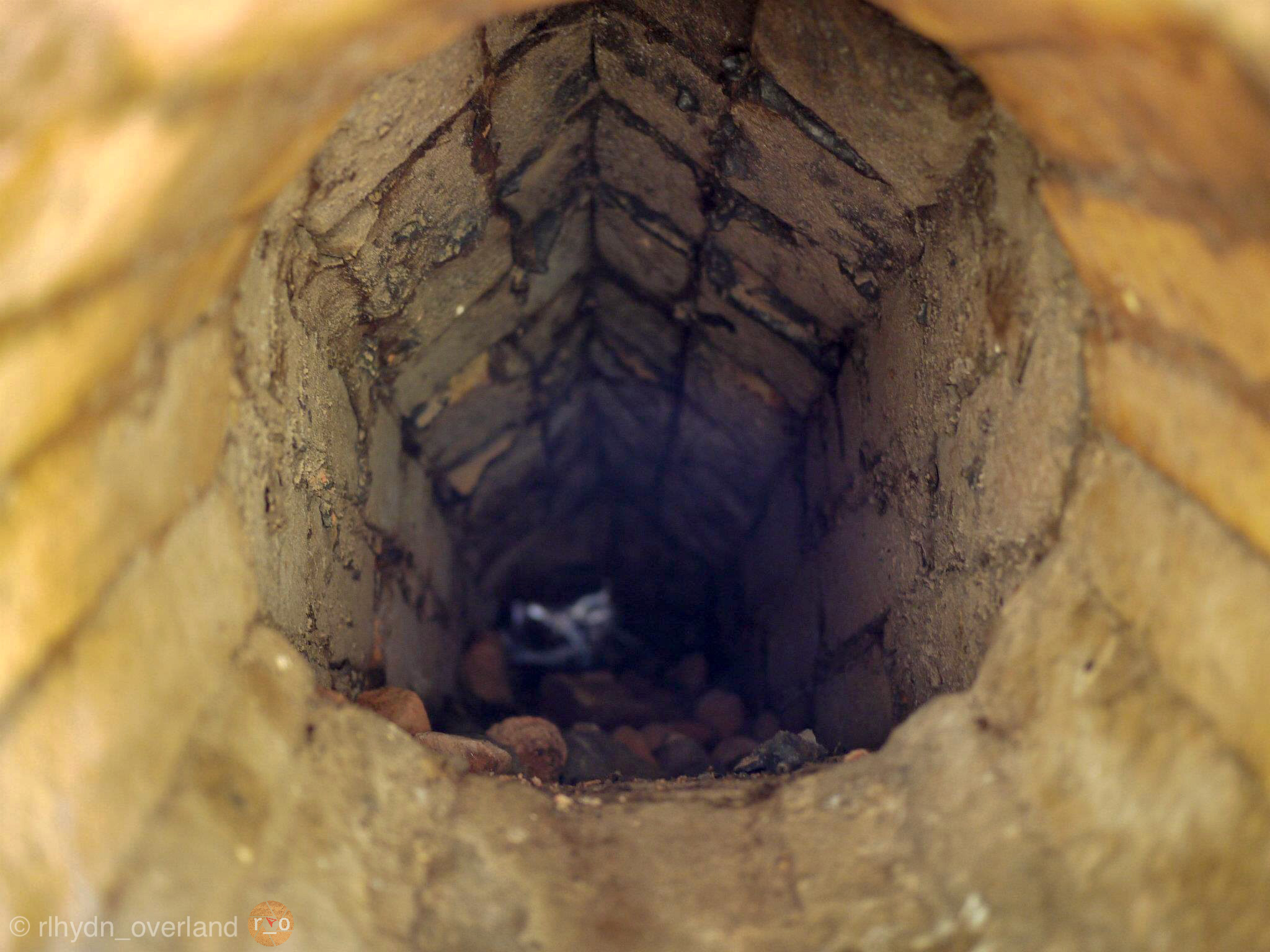
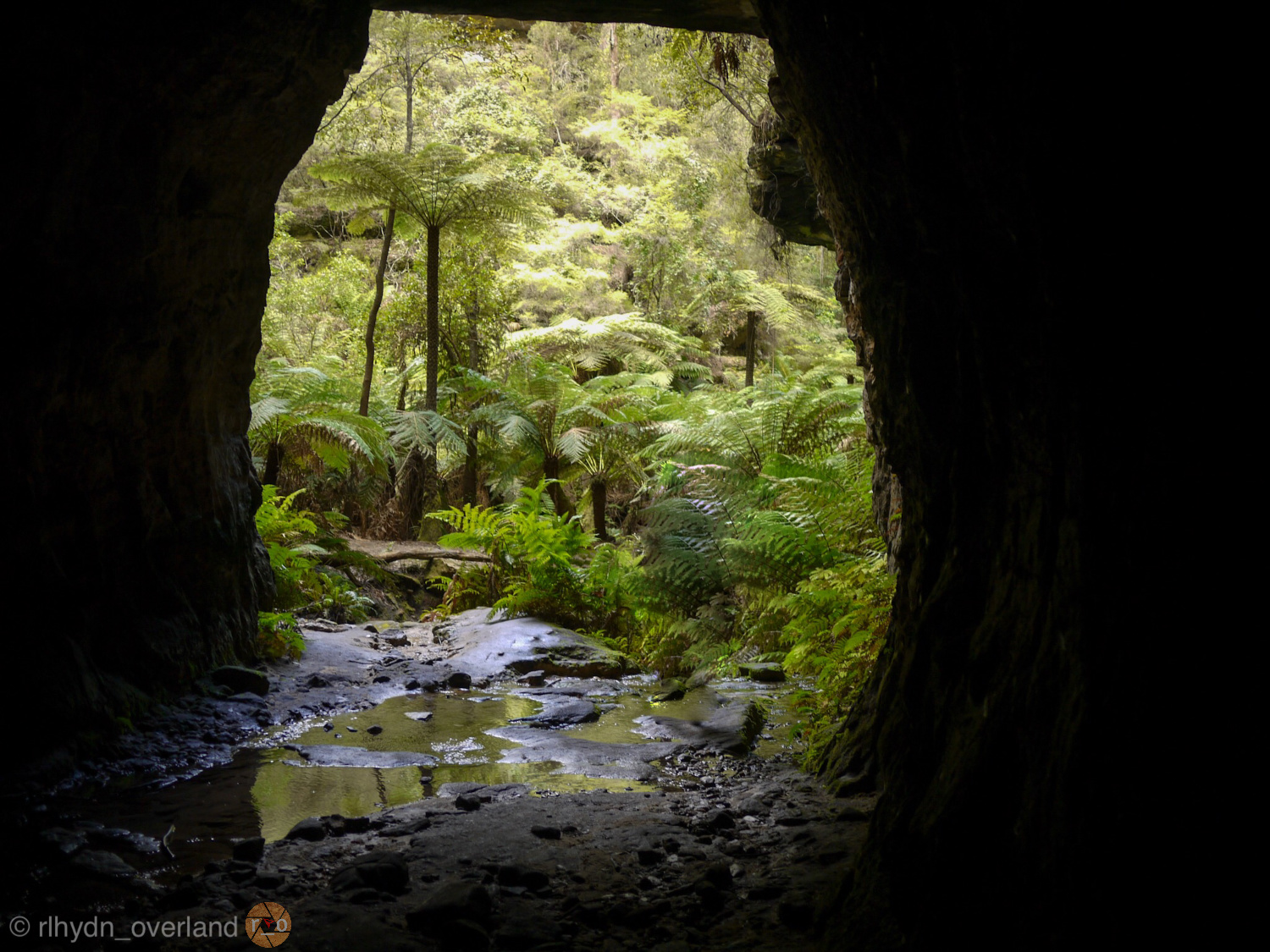
The Glowworm tunnel, can be reached by long return walk, following the railway, or on foot for a few hours, after a scenic drive. The tunnel originates from the old train line. 400m of dark. It’s usually wet, so bring a torch for your footwork but try not to disturb the glowworms on the walls and ceiling with your light. These are but two of many bushwalks in the area.
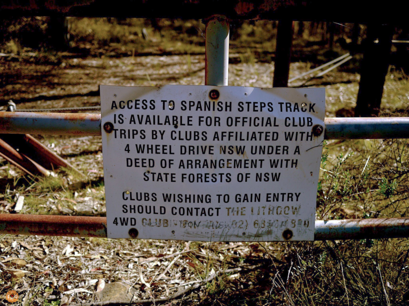
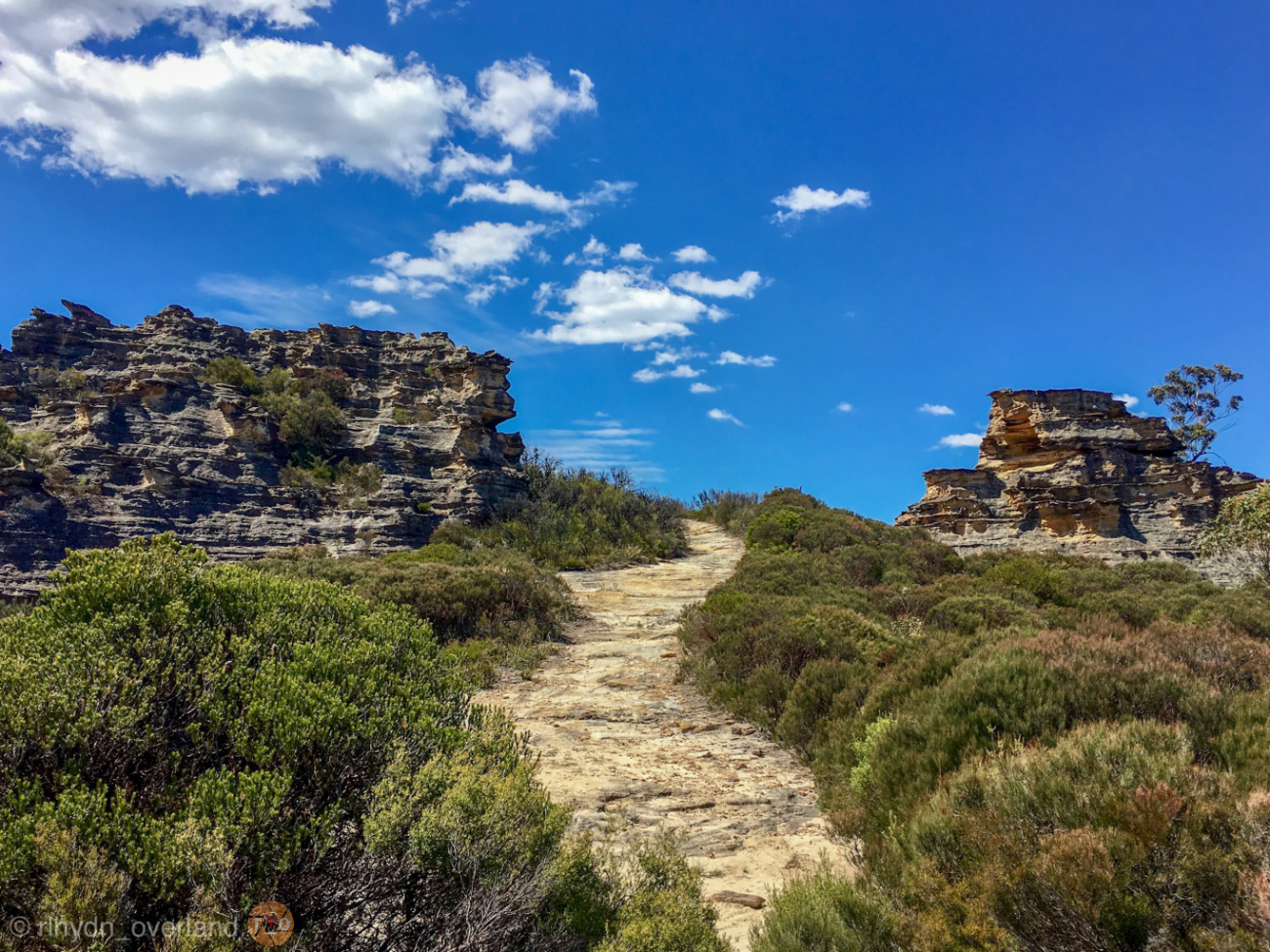
The area has a lot of driving. There are pagoda rock formations, aboriginal art and good old fashioned bushland to explore. Blackfellow’s Hand Trail is a varied initiation into the landscape and contains all of the above. The Spanish Steps can be found along the way.
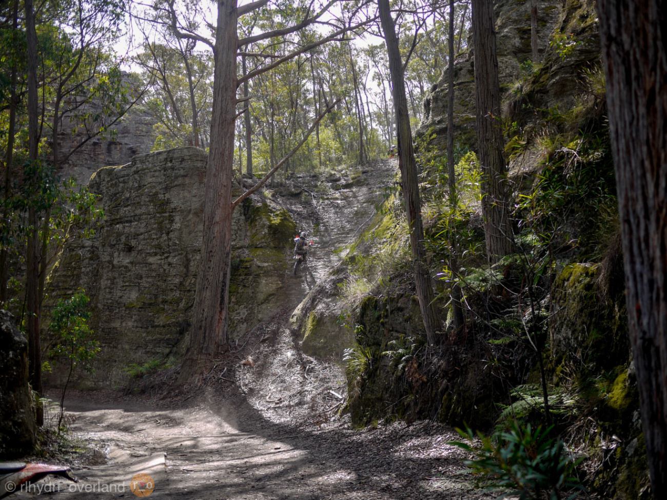
On the other end of the Blackfellow’s Hand Trail, you can find access to the Lost City. An impressive expanse of pagoda rock formations. For the more adventurous, there are other tracks to explore, dotted all over and around the Plateau.
Ben Bullen on the western side, follows the Bicentennial Trail and offers great views from the cliff top. It has two challenges, although for the first steep rocky section, you just need to pick your line.
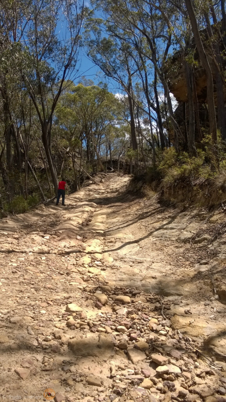

Further on, there is a large boulder to negotiate. It’s scarred by towballs and tyre rubber. There are trees nearby for your winch if climbing it.

Overnight walks and canyoning can also be found, their accesses secreted away in the thick and varied bushland.

Because of this, you will find the area occupied by all manner of campers. Furnished vans of the canyon seekers, caravaners, countless hiking and basecamp tents, and of course, four wheel drives with their rooftop tents and gazebos. We generally occupy our Oztent here, for easy shelter and privacy in the popular space.
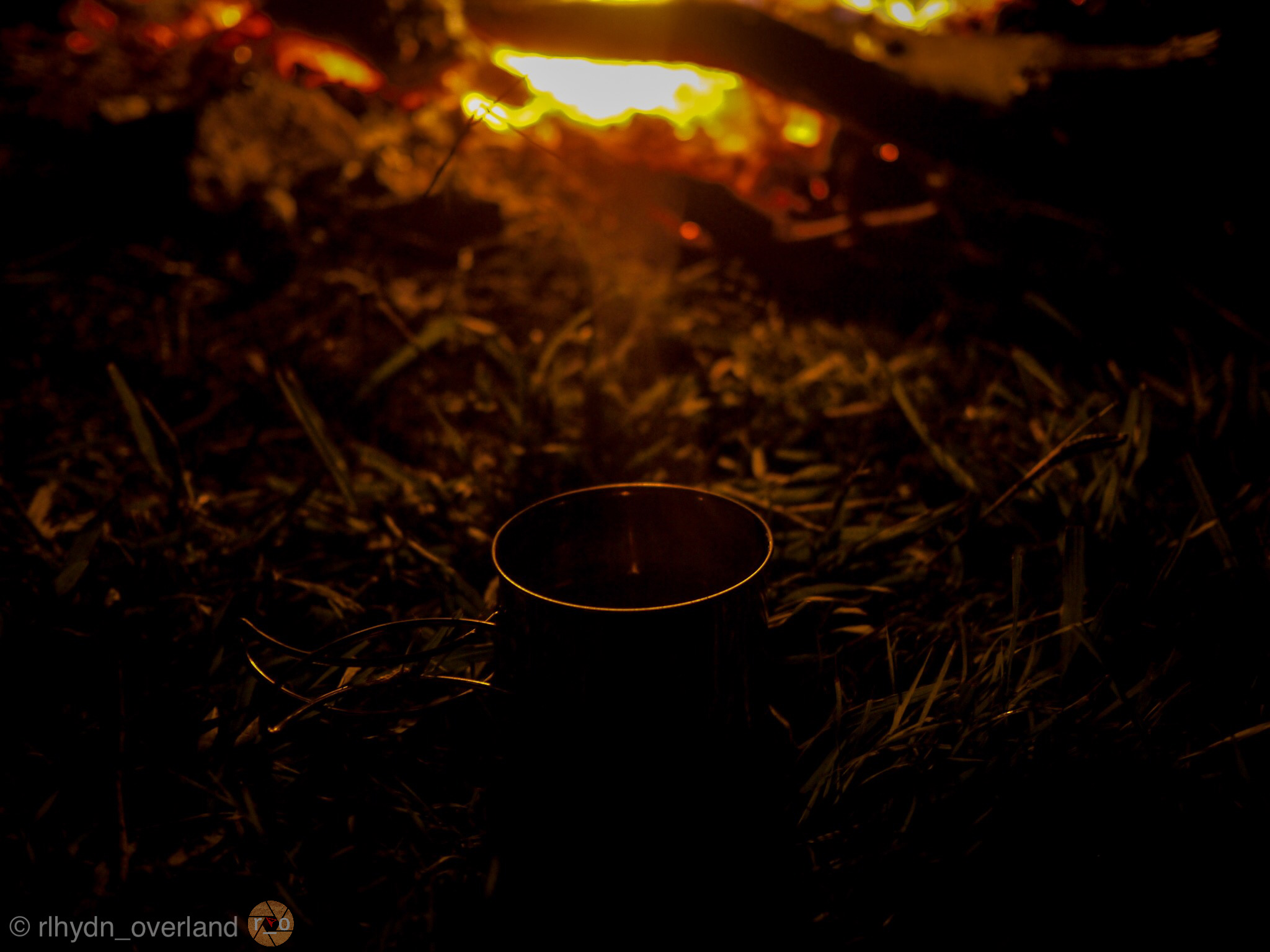
Campfires are allowed here, despite the seasonal ban of the surrounding National Park, except during Total Fire Bans. However, some of the best astrophotography and general stargazing, satellite, and meteor spotting can be watched instead. In winter though, bring your own firewood and your thermals. It gets icey cold and generators, chainsaws and dogs are not permitted.

Brunch or lunch in Lithgow on your way home as we do.
Newnes has the proverbial boxes ticked and we would rate it 8/10 which I can break down into kindling…..
1/2 Crowds: It can get busy on weekends, holidays.
2/2 Commute: Easy drive up and over the mountains from Sydney basin
1/2 Canine and kid friendly: Open spaces, swimming, no dogs allowed though
2/2 Camera and activities: Stunning cliffs, enchanting caves with mild to wild canyoning, 4wding and bushwalking
2/2 Camping facilities: Toilets and clear running water in the river to boil up
Quick Facts
Cost: Free (Paid camping available)
Nearest Facilities: Lithgow, NSW
Best time to visit: Any season, winter is COLD
For the official information, including important Alerts visit the National Parks website
Very well written and informative. Even though I lived in the mountains, we never went to this valley. Wouldn’t mind visiting.
Glad you enjoyed the read. I hope you get to visit there soon. As a local, it’s often our own backyards we forego for the wider horizon. That’s the explorer in all of us perhaps!
Very nicely written and the pictures. We have been to Glendavis years ago, very deserted!
My hubby’s cousin loved the place and was great friends with the pub owners and I believe he ran a kiosk before he passed away a few years ago. I would love to go camp there, I am disabled, we own a 23ft motorhome and I think the road in may be too hard to navigate for our rig. Thanks for the post, very enjoyable.
Nola
Thankyou for your kind words. Glen Davis is certainly easier access. The Ruins tour is quite special too. As for Newnes, I’m sorry I can’t offer advice on your van and the access, I have seen plenty of large vans at Newnes though. Happy travels!